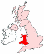
Wales Maps - District Maps for Welsh Towns
Useful road map of Wales, UK, with links to district maps for counties, towns and cities in Wales.
View Larger Map |
||
 |
||
Local District Street Maps for Welsh Towns and Cities
Wales Maps: With this easy to print map, you can see towns, villages and cities of Wales in the United Kingdom. Using this detailed Wales map, you can find your way around the country and locate streets, roads and facilities in Wales and Welsh places.
You can view maps of the largest cities, towns and villages (use links below).
Our Wales maps include:
- Detailed Map Pontarddulais District Wales
- Detailed Map Flint District Wales
- Detailed Map Llanfairfechan District Wales
- Detailed Map St David's District Wales
- Detailed Map Caldicot District Wales
- Detailed Map Bangor District Wales
- Detailed Map Bridgend District Wales
- Detailed Map Pontypridd District Wales
- Detailed Map Brecon District Wales
- Detailed Map Aberystwyth District Wales
- Detailed Map Tenby District Wales
- Detailed Map Caernarfon District Wales
- Detailed Map Llantrisant District Wales
- Detailed Map Ystradgynlais District Wales
- Detailed Map Aberdare District Wales
- Detailed Map Blackwood District Wales
- Detailed Map Mold District Wales
- Detailed Map Treharris District Wales
- Detailed Map Buckley District Wales
- Detailed Map Welshpool District Wales
- Detailed Map Pontardawe District Wales
- Detailed Map Colwyn Bay District Wales
- Detailed Map Mountain Ash District Wales
- Detailed Map Pontypool District Wales
- Detailed Map Pembroke Dock District Wales
- Detailed Map Blaenavon District Wales
- Detailed Map Pwllheli District Wales
- Detailed Map Bedwas District Wales
- Detailed Map Menai Bridge District Wales
- Detailed Map Merthyr Tydfil District Wales
- Detailed Map Haverfordwest District Wales
- Detailed Map Fishguard District Wales
- Detailed Map Porthmadog District Wales
- Detailed Map Caerphilly District Wales
- Detailed Map Conwy District Wales
- Detailed Map Milford Haven District Wales
- Detailed Map Llandudno District Wales
- Detailed Map Radyr District Wales
- Detailed Map Neath District Wales
- Detailed Map Llantwit Major District Wales
- Detailed Map Gorseinon District Wales
- Detailed Map Rhuddlan District Wales
- Detailed Map Gelligaer District Wales
- Detailed Map Barry District Wales
- Detailed Map St Asaph District Wales
- Detailed Map Burry Port District Wales
- Detailed Map Cardigan District Wales
- Detailed Map Tredegar District Wales
- Detailed Map Bethesda District Wales
- Detailed Map Rhymney District Wales
- Detailed Map Swansea District Wales
- Detailed Map Chirk District Wales
- Detailed Map Pencoed District Wales
- Detailed Map Pembroke District Wales
- Detailed Map Brynmawr District Wales
- Detailed Map Holywell District Wales
- Detailed Map Ammanford District Wales
- Detailed Map Penarth District Wales
- Detailed Map Denbigh District Wales
- Detailed Map Porthcawl District Wales
- Detailed Map Abercarn District Wales
- Detailed Map Ebbw Vale District Wales
- Detailed Map Wrexham District Wales
- Detailed Map Newbridge District Wales
- Detailed Map Risca District Wales
- Detailed Map Bargoed District Wales
- Detailed Map Connah's Quay District Wales
- Detailed Map Monmouth District Wales
- Detailed Map Shotton District Wales
- Detailed Map Abergele District Wales
- Detailed Map Ruthin District Wales
- Detailed Map Port Talbot District Wales
- Detailed Map Newport District Wales
- Detailed Map Cardiff District Wales
- Detailed Map Llanelli District Wales
- Detailed Map Blaenau Ffestiniog District Wales
- Detailed Map Rhyl District Wales
- Detailed Map Maesteg District Wales
- Detailed Map Cwmbran District Wales
- Detailed Map Chepstow District Wales
- Detailed Map Llandrindod Wells District Wales
- Detailed Map Newtown District Wales
- Detailed Map Caerleon District Wales
- Detailed Map Carmarthen District Wales
- Detailed Map Abergavenny District Wales
- Detailed Map Abertillery District Wales
- Detailed Map Prestatyn District Wales
- Detailed Map Holyhead District Wales
- Detailed Map Llangefni District Wales
- Detailed Map Senghenydd District Wales
Maps of Northern Ireland - Maps of England - Maps of Ireland